
Grow Your Business with Aerial Videography in Atlanta
- humbirdvisuals
- Jul 24, 2025
- 7 min read

You experience your business up close, daily. But from that height, what details truly slip away?
Gain a fresh outlook, and you'll uncover details and a full story that words or photos from the ground can never capture.
Imagine breathtaking shots from the sky. Suddenly, your customers see your brand in a completely new light.
Picture yourself giving a client a complete view of their building site, high above the ground.
Or, it lets someone house hunting get a full picture of their next neighborhood from way up. Forget simple snapshots. Advanced drone videography offers a clear way to demonstrate your product's value or map out solutions to site-specific issues.
Ready to capture your Atlanta construction project from above?
Contact Humbird Visuals to schedule your professional drone services today!
On This Page:
Why Your Atlanta Business Needs Aerial Views
You might think aerial cinematography is just for big movie productions.
However, businesses right here in Georgia are utilizing drones to expand, enhance safety, and reduce costs.
For Construction Projects
Construction sites are dynamic environments, constantly moving and changing.
Trying to track everything with photos from the ground is tough.
It is challenging to gain a clear understanding of the project's scale and development from that limited perspective.
Aerial video provides a comprehensive overview in minutes, enabling you to make informed, actionable decisions.
You can monitor progress week after week from the exact same flight path using captured aerial images.
This documentation helps keep projects on schedule and on budget.
It is also a significant advantage in terms of safety. A drone pilot can spot potential hazards from above without sending a person into a dangerous area.
Stakeholders and investors can also see progress with clear, compelling drone videos, keeping everyone on the same page for any commercial real project.
A Real Estate Game Changer
How do you sell a property?
You sell the lifestyle and the location.
Standard real estate photography struggles to show a home's relationship to its surroundings or the full extent of the property.
An aerial video can show off a large yard, the beautiful park down the street, or how close the home is to local attractions.
This context helps buyers connect with the property before they even step inside, making your listing feel premium.
Offering a comprehensive photo package that includes aerial photography is essential.
Listings that use aerial imagery and video stand out from the competition.
Capturing stunning views helps properties sell faster and for a higher price.
You are not just selling four walls; you are selling a place in the community, and an aerial photo can show that perfectly.
Powering the Energy and Telecom Sectors
Think about inspecting a wind turbine or a cell tower. Traditionally, this meant a person had to climb a dangerous structure.
This process is slow, expensive, and full of risks for technicians.
Drones change all that.
A trained drone operator can safely remain on the ground while the drone captures detailed, close-up footage of the equipment.
This is a much faster and more cost-effective way to handle inspections.
With specialized cameras, drones can do even more.
Thermal imaging can find heat leaks or malfunctioning solar panels.
This type of aerial imaging provides critical data for maintenance, helping to prevent failures before they occur.
Farming Smarter with Drones
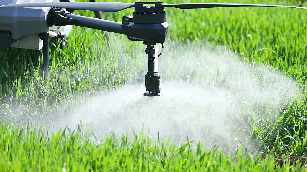
Agriculture is another industry seeing huge benefits from a bird's-eye view. A farmer cannot walk their entire property every day.
So how do they know which areas need more water or are showing signs of disease?
Drones with special multispectral cameras can fly over fields and collect data on crop health. This information helps farmers apply resources, such as water and fertilizer, only where they are needed.
It is called precision agriculture, and it saves money while increasing crop yields.
Also known as precision agriculture, this approach leads to more sustainable farming practices.
Farmers can get better results while using fewer resources.
Beyond Just Flying: The Different Types of Aerial Services
Aerial video is amazing, but it is just one part of what professional drone companies offer. Drones are platforms for collecting a wide range of data.
Here are some of the key videography services and aerial services you can get for your Atlanta business.
Progress Monitoring: Regular, repeated flights over a construction or development site create a time-lapse record of progress. These consistent aerial shots provide an invaluable visual log for project managers and stakeholders.
Inspections: Drone operators get up close to buildings, roofs, towers, and bridges to check for damage or wear without putting people in danger. These drone footage services provide high-resolution visuals for detailed analysis.
3D Mapping & Modeling: Drones take a ton of pictures – sometimes thousands! It then blends them all to build a super clear, detailed 3D picture of any place or building. These models are essential for planning, measurement, and design in commercial real estate and construction.
Orthomosaic Mapping: An orthomosaic map is a large, detailed, and geographically corrected aerial photo of an area. Unlike a simple drone photo, it is uniform in scale and can be used for accurate distance and area measurements.
Thermography: Using infrared cameras to detect heat signatures. This is great for finding insulation problems, water leaks, or issues with solar panels and electrical systems.
LiDAR: This stands for Light Detection and Ranging. This gadget shoots out laser light to measure distances. It then crafts highly accurate 3D maps and models, allowing for a clear view through dense vegetation.
Mastering the Shot: Techniques for Compelling Drone Footage
Great aerial videography is more than just flying a drone; it's about capturing the perfect shot.
Creating truly breathtaking drone videos requires a combination of technical knowledge and artistic vision.
Professional drone pilots understand the nuances that separate simple drone footage from stunning cinematic aerial content.
Composition is a major factor.
Pilots employ classic filmmaking techniques, such as the rule of thirds, leading lines, and framing, to draw the viewer's eye.
A well-composed drone shot tells a story and feels balanced and professional.
Movement is also critical. Smooth, deliberate movements are preferred over erratic, jerky flying.
Common techniques include reveals, where the drone rises to show a larger scene; tracking shots, which follow a moving subject; and orbital shots, which circle a point of interest to show it from all angles.
Here is a breakdown of common shot types:
Shot Type | Description | Best Use Case
|
Dolly Shot | Moving the drone forward or backward in a straight line. | Revealing a subject or moving through a space. |
Trucking Shot | Moving the drone left or right while the camera faces forward. | Following a subject or revealing the length of a property. |
Orbit Shot | Flying in a perfect circle around a subject. | Showcasing a central point of interest, like a building or statue. |
Pedestal Shot | Moving the drone straight up or down. | Revealing a landscape or showing the height of a structure. |
The Tech Behind Breathtaking Aerial Videography
Getting those smooth, cinematic shots is not as simple as just putting a camera in the air.
The quality of the final product depends heavily on the equipment being used and the person flying it.
It is a blend of advanced drone technology and human skill.
Choosing the Right Drone

Not all drones are created equal, and different jobs need different tools. A small, nimble drone might be perfect for filming a real estate property.
Many photography services use these smaller aircraft for their agility and ease of use.
A larger, more powerful drone is required to carry a heavy LiDAR sensor for surveying or a cinema-grade camera.
These professional systems feature advanced capabilities.
GPS stability and obstacle avoidance help make flights safer and smoother.
This technology is also continually improving, allowing drone operators to capture shots that were previously impossible just a few years ago.
It's All About the Pilot
A great drone is nothing without a great pilot.
Flying a drone safely for commercial purposes requires skill and knowledge.
The drone pilot is responsible for the safety of the flight and the quality of the captured drone footage.
In the United States, anyone operating a drone for business purposes must be certified by the Federal Aviation Administration (FAA).
This certification, the Part 107 Remote Pilot Certificate, is commonly referred to as a drone license.
It means the pilot has passed a test on airspace rules, weather, and drone operations.
Hiring a certified pilot is critical for any photography business or client.
It protects you from liability and means your project is in the hands of a professional who knows how to operate legally and safely.
A skilled pilot with experience working on similar projects also understands camera settings and shot composition, which are just as important as flying ability.
What to Expect When Hiring a Drone Service Provider
So you have decided your business could use some high-quality aerial video.
What does the process look like from start to finish?
Working with a professional company that offers drone services is a straightforward experience.
Here is a step-by-step look at how a typical project unfolds.
Initial Consultation: It starts with a conversation. You will discuss what you want to achieve with the video. Are you selling a property, monitoring a job site, or creating a marketing piece?
Site Survey and Planning: The pilot will then conduct a site survey and planning at your location. They check airspace regulations to ensure that flying there is both legal and safe, using the FAA drone map. They will also plan flight paths and shot lists based on your goals to capture aerial views efficiently.
The Shoot Day: On the day of the flight, the pilot arrives and performs pre-flight safety checks. They will operate the drone to capture the planned shots. Communication is important to ensure they provide exactly the aerial videos you need.
Post-Production Magic: The raw footage is just the beginning. In post-production, the clips are edited together to create a cohesive sequence. This includes color grading to make the video stand out, adding music, and incorporating graphics or text to create compelling marketing material.
Final Delivery: Once the edit is approved, you will get the final video files. The company will ensure fast turnaround times and format the files for whatever platform you need, whether it is your website, social media, or a presentation.
Conclusion
Seeing your work from a new perspective is powerful.
It can reveal opportunities, enhance safety, and tell a story that resonates with people.
For businesses in Atlanta, from construction and commercial real estate to energy and agriculture, this technology is already proving its worth.
It is an investment in better data, smarter decisions, and more compelling marketing.
Ready to capture your Atlanta construction project from above?
Contact Humbird Visuals to schedule your professional drone services today!


Comments